Follow Us On :

GIS Mapping

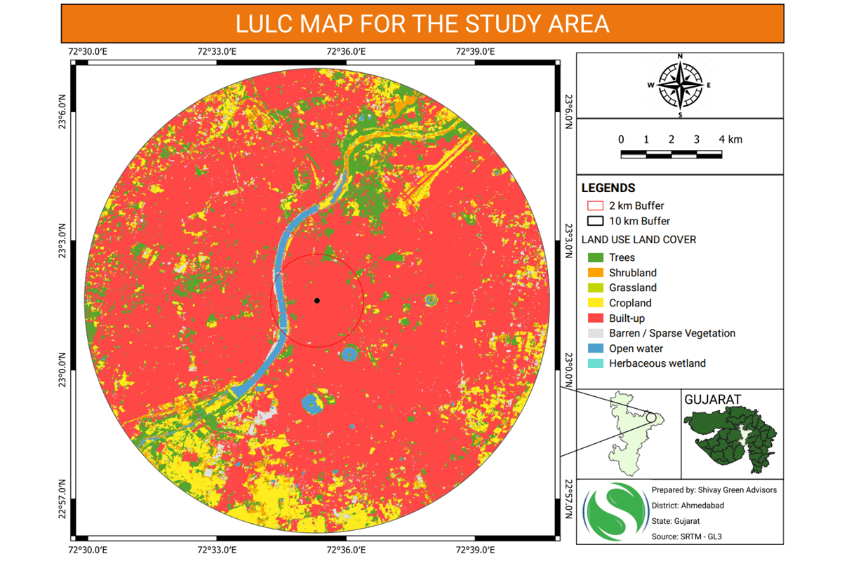
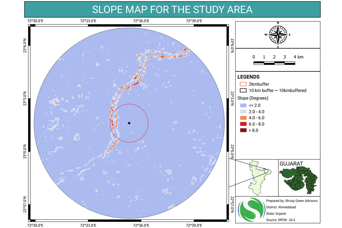
At Shivay Green Advisors, our team of GIS experts is dedicated to providing specialized mapping services that cater to the environmental sector. Leveraging advanced Geographic Information Systems (GIS) technology, we deliver precise and comprehensive spatial analyses that are critical for environmental planning, assessment, and management.

Our GIS Mapping Expertise Includes

Terrain and Topographical Mapping

Detailed Terrain Analysis: We create high-resolution maps of terrain features, offering crucial insights into landform characteristics, elevation, and slope analysis for environmental impact assessments.

Land Use and Land Cover Mapping

Land Use Identification: Our experts map and classify land usage patterns, helping to assess changes over time and plan for sustainable development.

Vegetation and Land Cover Analysis: We provide detailed mapping of vegetation types and other land cover features, essential for biodiversity assessments and habitat conservation efforts.

Water Resource Mapping

Hydrological Mapping: We offer comprehensive water resource studies, including mapping of surface water bodies, watersheds, and groundwater resources, which are vital for water management and conservation.

Flood Risk and Wetland Mapping: Our GIS services include floodplain mapping and wetland delineation, essential for environmental protection and sustainable water management.

Soil and Geological Mapping

Soil Characteristics Mapping: We conduct detailed soil surveys and mapping, crucial for evaluating soil health, fertility, and suitability for various land uses.

Geological Investigations: Our GIS experts create geological maps that provide valuable insights into subsurface conditions, aiding in risk assessments for construction and land development projects.

Environmental Impact Assessments (EIA)

 Impact Analysis Mapping: We integrate GIS mapping with EIA processes to assess potential environmental impacts of proposed projects, including infrastructure development, industrial activities, and resource extraction.

Sensitive Area Identification: Our GIS tools help identify environmentally sensitive areas, such as wildlife habitats, protected regions, and heritage sites, ensuring that development activities are carried out responsibly.

Air Quality and Climate Mapping

Air Quality Monitoring: We use GIS to map and analyze air pollution sources, distribution patterns, and impacts, supporting efforts to improve air quality and public health.

Climate and Weather Pattern Analysis: Our GIS services include mapping of climate data, such as rainfall patterns and temperature variations, aiding in climate change studies and adaptation planning.

Urban and Rural Planning Support

Infrastructure and Zoning Mapping: We provide GIS-based mapping for urban and rural planning, including road networks, utility infrastructure, and zoning plans, ensuring efficient and sustainable development.

Environmental Compliance Mapping: Our experts create maps that assist in regulatory compliance, including environmental clearances, land use regulations, and conservation planning.

GIS and Environmental Impact Assessment